Wednesday, July 27, 2011

A Memorable Trip Concludes on High Notes

Today I'm wrapping up my journal of my and Judy's trip to Buffalo Tavern Bed and Breakfast and all points within 20 miles.  Well, that's what it seemed like, but we were there less than 48 hours.  Let's pick up with late Tuesday afternoon, when we turned off the Blue Ridge Parkway to see a couple of sights in and around Glendale Springs, NC.

This is one of the famed Churches of the Frescoes, with masterful works of art by world-renowned Ben Long.  We had been here before, so didn't linger.

As always, the church doors were open to welcome guests.

This is the fabulous frescoe of "The Last Supper."

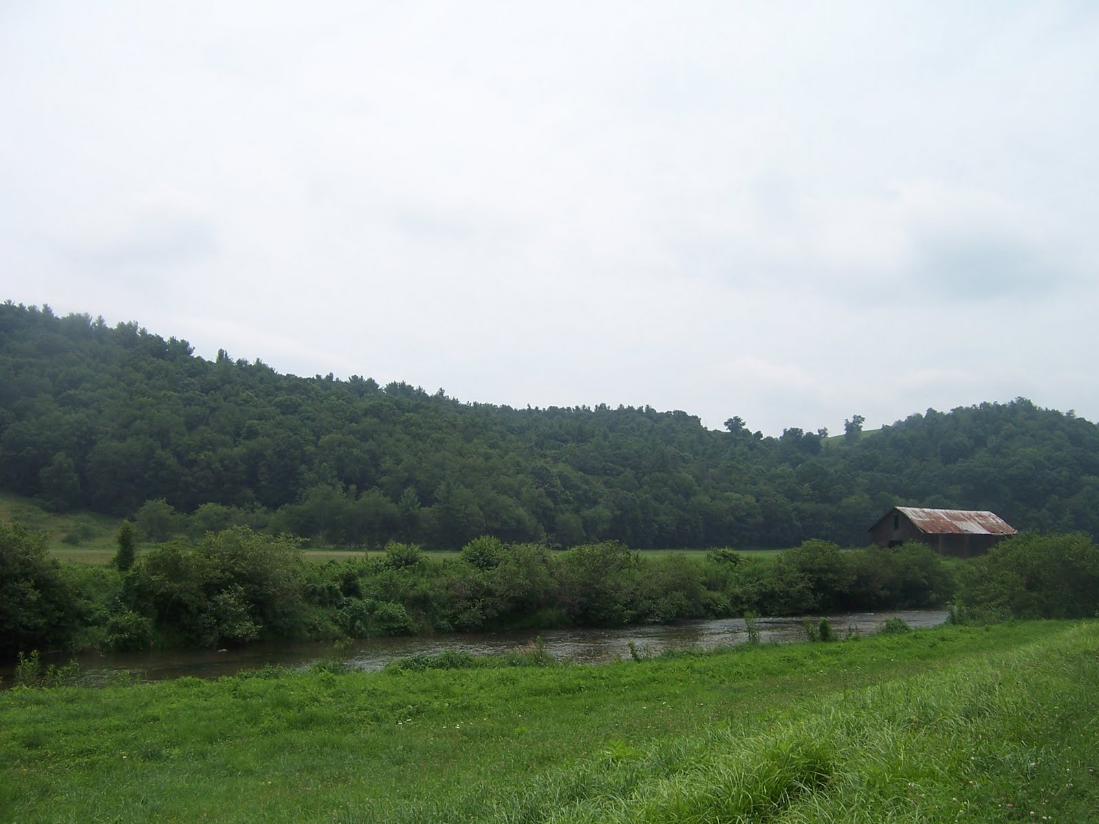
Judy's brother Tim ("Hi, Tim") is an expert at ferreting out interesting but little-places places.  He had told me how to find an out-of-the-way Methodist campground with abundant views of the New River.  Here's where we crossed the river-- getting close.

Imagine those lucky campers.

Very inviting waters, but not today for us.

Elk Shoals United Methodist Camp-- God's Country.
And they're not exaggerating!

The camp office where we were directed to register was not manned.  We saw a few folks enjoying a riverside beach, but apparently no groups were staying at the camp during that week.  Tim's family had seen it brimming with campers on a weekend.

Heading back to the Parkway, we stopped for a short stretch break at the Northwest Trading Post.  Nice facilities and a wide variety of books, mountain crafts, and souvenirs.

As I stood on the front lawn of the trading post and took in the panoramic vista, I thanked God for places where we can still retreat to have time to think, smell the flowers, and appreciate the greatness of His gifts to us.

This angle shows the venerable Blue Ridge Parkway, established and long protected by wise men of vision.  I pray that we, as a state and nation, don't abandon this and other national treasures that bless, instruct, and enlighten our citizens.


We exited the parkway at Laurel Springs and followed a scenic route back to Jefferson.  We wanted to wait a little while before eating, so I followed a sign to the Ashe County Park, about 3 miles out of town.  We were pleased to see a spacious park with facilities of every kind.  There were ballfields, picnic areas, a lake for fishing or swimming, a frisbee golf course, and more.  These ducks certainly had no complaints.

Here's a glimpse of the pond, still affording a wonderful view of old Mount Jefferson, even though we were miles further away.

While at the park, our appetites struck with a vengeance, and we headed off to a place worthy of such a voracious hunger-- Shatley Springs.
This place has been known to us for more than 30 years, but we had not been sure it was still open until we inquired with our innkeeper, Doc.  He told us he had eaten there twice recently and that they still offered the old family style all-you-can-eat meal, but you can also order from a menu.

We both found meals to suit our palates on the menu; Judy got the vegetable plate (plus one) and I got the baked ham dinner (plus one).  We had all we could handle and at a very reasonable price.  Then we drove through the grounds for old times' sake.  We were happy to see all buildings were in good repair with a fresh coat of redwood paint.  But mostly, I was happy about the restaurant!

So dusk brought us back to our homey, cozy Bed and Breakfast, where we would have another night of restful repose before heading homeward refreshed.  I highly recommend that you take a glance at the following website, which has numerous glowing reviews of Buffalo Tavern.

So farewell, Doc.  So long, Buffalo Tavern.  We'll be back, Blue Ridge Mountains.
And as for you, dear readers, I'll see you soon!

Tuesday, July 26, 2011

Up, Up, Up to the Blue Ridge Parkway

After leaving Todd, we got on the Blue Ridge Parkway and drove north a few miles, searching for an ideal picnic spot.  We had had a substantial breakfast at the Buffalo Tavern B&B, so we only wanted an energy boosting snack to tide us over till supper.  We found our ideal spot at the small E. B. Jeffress roadside park.  He is honored as one who was influential in routing the parkway through the scenic North Carolina mountains.


Just steps from our shady picnic table was this view of the rolling hills of the piedmont just to our east.

We had stopped at this location several years before and were eager to hike the Cascades Trail after our snack.  The sign, touting a "leisurely 30 minute round trip walk" is slightly misleading.  No trail with such a steep descent is truly "easy."  Parts were moderate, but if you went to the furthest overlook of the cascade falls, you faced a strenuous climb back up.  It's well worth every step, but be forewarned if you go there.  Leisurely?  I'm not so sure.

It also took us closer to an hour than 30 minutes, but I can't fault the trail.  I took a ton of pictures.  One thing I love about North Carolina's parks and trails is that even the man-made components are compatible with the overall emphasis on making nature more accessible without detracting in the least.
Here's Judy.  She didn't need rest.  She just had to wait for me.

Turn about, fair play.

The whole trail was nice, but the Cascades was our destination.  We went down many, many steep steps for this view.  You can't even see the bottom.

Here's a fine example of the work others have done to make viewing safe and user-friendly.  In other words, to try to keep daredevils from getting themselves killed by getting too close!

There's an upper and lower viewing area.  After hiking this far, it's silly not to do both.

In the following video I tried to film the falls from top to bottom.  I can't really recapture the sense of being there, but I hope this helps.  Single photos just can't do it.

What had seemed steep coming down was even more daunting going up.  This is just one of multiple flights of stone steps.  Judy had a brilliant idea: we stopped every 15 steps to catch our breath.  What part of "leisurely" did the sign-makers not understand?  But truly, we had not one regret.  And a challenging trail always gives you a sense of accomplishment.
You know, like "We came, we saw, we conquered."

Part of the loop trail doubles as a portion of the Mountains-to-Sea Trail, which will one day run continuously from our western mountains, through the piedmont, all the way to the Atlantic Ocean.  Every year, more segments of the trail are completed, including some urban areas.  What a great addition to our state's outdoor opportunities.

In my next post, the final one of six about our trip, we'll take a brief sidetrip off the parkway, then follow it northward until returning to the Buffalo Tavern at day's end.
If you've had the patience to stick with me this far, don't miss the final installment.  Coming soon.

Historic Todd, Railroad Town Amidst the Blue Ridge

Continuing on our journey from the base of Mount Jefferson (see previous blogs), Judy and I followed U.S. 221South to Hwy. 194.  This scenic byway led us through beautiful plunging valleys and lush, green hillsides as it wound its way to the now-quiet town of Todd.  In the distant past, this area was a trading crossroads for the Indians, then the incoming English and Scots.


In the early 1900's it became an important railroad town along the Norfolk & Westerns mountainous route.  The town boomed for nearly two decades, from 1915-1933, after which the boom was over, and Todd returned to its earlier quiet status.  This caboose commemorates those glory days.  Just beyond it lies the South Fork of the New River.

Click on this plaque to enlarge it and read the interesting saga of this town for yourself.  You'll be surprised to read that Todd once boasted three hotels, a Ford garage, FOUR doctors, and much more.  Worthwhile reading.

What was once the Todd Mercantile store is now a nice bakery and gift shop.  They were advertising for an upcoming songfest featuring the legendary Doc Watson, who lives in nearby Deep Gap.

Other than the draw of pure history lovers, the Todd General Store is the primary tourist attraction.  And it had a fair amount of customers and lookers for a Tuesday morning when we were there.  Similar to the famed Mast General Store, it has a little bit of everything, and then a goodly amount of the unexpected.  Definitely worth a visit.  We were also impressed that they host storytellers every Tuesday night.  I couldn't resist asking if they ever featured my favorite Jack Tales, and I was pleased to hear that they frequently do.

This old barn is just a few dozen steps away from the general store.  Many of the old buildings have been gone for years.

Just across the New River from the town park are a few dwellings with some aged outbuildings and sheds still standing.  On one boulder at the river's edge we saw a couple of pairs of tennis shoes.  How idyllic to have a permanent swimming hole right out your back door.

This is the town park I mentioned.

There were a couple of families enjoying the park this day, but I could imagine it being packed for weekend songfests.

Departing from Todd, we followed Railroad Grade Road for three miles before crossing the New River.  We saw scenes like this all along the way.  In fact, it was when Amanda was at Appalachian and showed us pictures of the rustic environs of Todd that we first learned of this place.

Old buildings like this may not be serviceable, but they are a testimony to the labors of past generations, tilling the ground, selling their wares, and somehow squeezing out an existence far from the main highways.

How long can it be before this old shed is totally overgrown?  But just on the other side of it, hidden from view, is a modest, comfortable house.  Can you see the old TV antenna at the back of the shed?  Once a luxury to even allow weak TV reception, I'm sure it's given way to satellite service now.  And the mountain folks deserve any modern convenience they can get nowadays.  They've long since paid their dues with toil and hardship.

Just past that last shed, we crossed the New River, followed yet another winding road back to U.S. 421east of Boone, then sought out the Blue Ridge Parkway.  There we would enjoy an energizing snack before exploring the wayside trails and overlooks which continually draw us back for more.  Pictures coming soon!

Monday, July 25, 2011

Up Mount Jefferson

This view of Mount Jefferson was in my previous blog.  Tuesday morning of our trip, after a delicious breakfast at our B&B, Judy and I headed up the mountain for some views and some hiking.

Parts of our mountaintop trail might prove too steep for many folks, but much of it was fairly level, following a ridge.

This "Warning" is included here for LIZ and others who casually risk their lives for "a better look."  What would we do without you?!

The main trail ends at Luther's Point, affording spectacular views in three directions, even on an overcast day.

All along the ridge we glimpsed many chestnut saplings.  Chesnuts were once one of the dominant hardwoods in the Appalachians, but since the infamous chestnut blight of the 1920's, the young trees don't survive to adulthood.

This stunted tree demonstrates the devastation of the blight.  It will grow no taller, and its wood is of little use.

Judy's sharp eyes spotted this marvel of the woodlands, Indian Pipe.  I first encountered it at Camp Cherokee, but from year to year it is unpredictable where it will appear.
to see some great photos and learn more about this unusual plant, which is also called Ghost Plant and Corpse Plant.

AAAGGHHH! SNAKE   SNAKE!
Oops.  My mistake.  A woodcarver cut notches in this log crossing the trail to provide traction if you step on it.  Such logs are often damp and slippery on mountain trails, so that was very thoughtful.  Unlike my cruel joke.

This neighboring mountain has a nice symmetry to it, as well, but not as famous as Mount Jefferson, apparently.  Location, location, location.

I don't normally get close to sheer dropoffs for photos.  My knees would get weak, my head would spin, and that might be the end of my blogging days.
But this was more of a "bounce and roll off," and I was brave enough to get this close.

There are hundreds of varieties of ferns, and I didn't recall seeing one just like this before.  Ferns, lichens, and fungi compete and survive well in this harsh mountain environment.

The one time I used the camera's self-timer, an unyielding wind gave me a mohawk look.  That's the last time I want to see that on me!

Now here is a sheer dropoff I wouldn't have photographed if I hadn't had the railing to stand behind.

This display identifies not-too-distant mountains that can be viewed from Mount Jefferson.  Click on the picture to enlarge it and learn some interesting facts.  Judy and I have been to Whitetop Mountain in Virginia.  The Virginia Creeper of the Norfolk & Western Railroad once crossed that peak, and it was the highest point on any railroad east of the Mississippi River.  Judy and I have plans to bike the Virginia Creeper trail in the future.

On a somewhat overcast day we couldn't identify the mountains with certainty, but the view was exhilirating, anyway.

Time to head down the mountain.
Next, we'll follow one of North Carolina's scenic byways along winding, scenic valleys to reach the old railroad town of Todd.  Coming soon.